Our services
GIS & Web mapping
At GEOTAUR, we specialize in GIS (Geographic Information System) services that empower your projects and deliver valuable benefits. Our expertise ensures data-driven decision-making, efficiency, and precision in spatial data analysis. We enhance your strategic planning, simplify complex data for effective communication, provide real-time insights, and foster seamless collaboration.
Data-Driven Decision-Making
Our GIS services are designed to provide you with data-driven insights that guide informed decision-making. With GEOTAUR, you’re equipped to make strategic choices based on comprehensive spatial data analysis.
Efficiency and Optimization
We understand the importance of efficiency in your projects. Our GIS applications are built to streamline operations, optimize workflows, and reduce costs, ensuring your projects run smoothly and cost-effectively.
Precision and Quality
Precision is paramount in GIS, and GEOTAUR delivers. We work with the highest level of accuracy in spatial data, minimizing errors and upholding the quality of your results.
Strategic Planning
Our GIS solutions elevate your planning processes, be it for transportation, urban development, or resource management. We empower you to plan strategically, mitigating risks and maximizing success.
Clear Communication
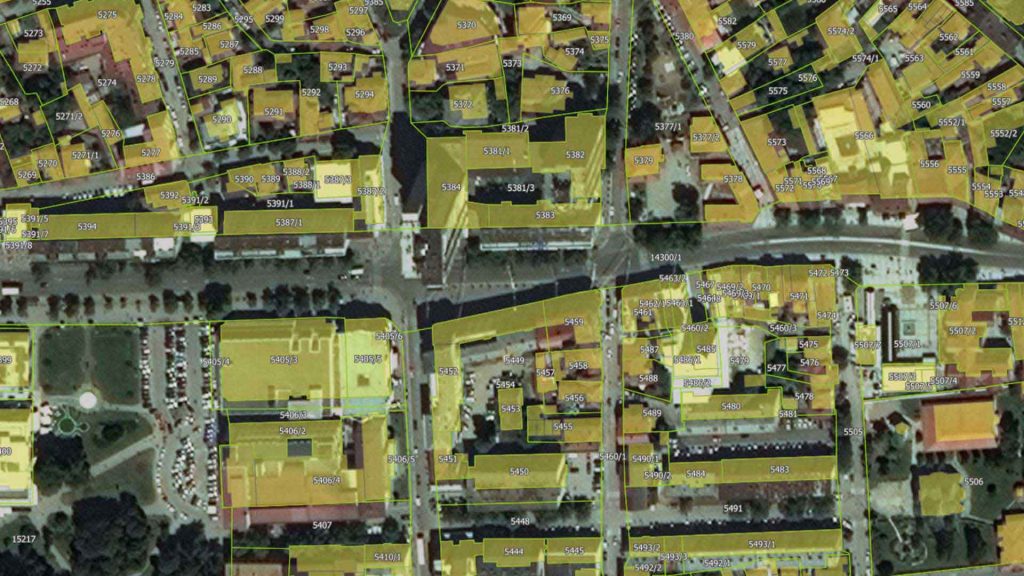
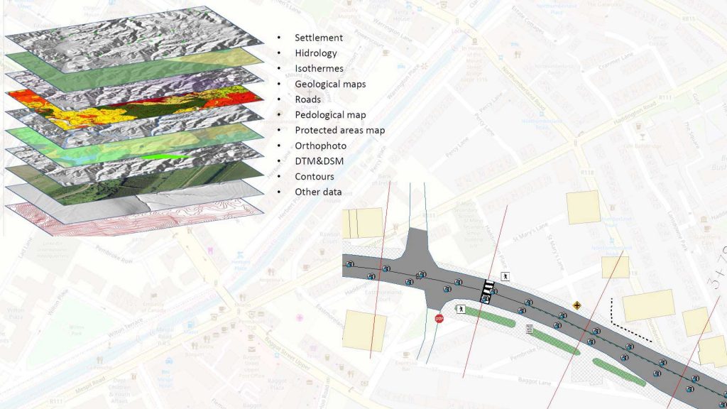
Satellite Images Photogrammetry: GEOTAUR experienced in processing satellite images. We use this technology to create topographic maps, hydrologic maps, digital terrain models, orthophotos, and various other applications.
Real-Time Insights
Stay ahead of the curve with real-time data integration. Our GIS applications keep you updated with live feeds and sensor data, providing you with the most current insights for proactive decision-making.
Accessibility and Collaboration
Collaboration knows no boundaries with GEOTAUR’s GIS solutions. Access spatial data and analysis from anywhere, fostering collaboration among team members, stakeholders, and partners, regardless of their location.
What Sets Us Apart:
GEOTAUR is at the forefront of innovation in the GIS industry. Our commitment to excellence and dedication to staying at the cutting edge of GIS technology make us a leader in the field. We continuously strive to deliver value to our clients by pushing the boundaries of what GIS can achieve.


Need some help?
We enjoy professsional challenges and we are confident that we’ll find the best solution for our clients.