Our services

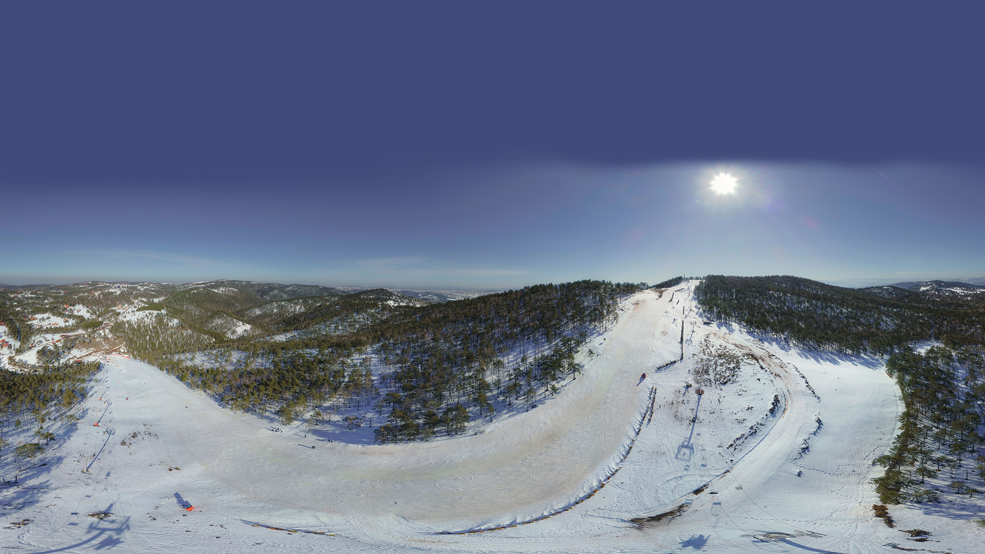
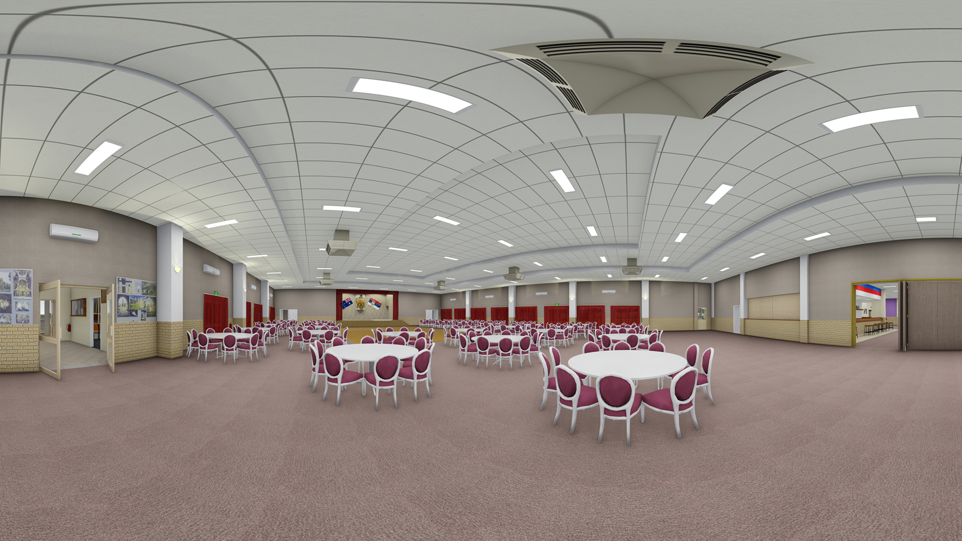
Panoramic imaging and web based point cloud viewer – PANOTAUR

PanoTaur is your go-to Virtual Tour creation software, offering a seamless way to explore real-world panoramas and digital models.

Whether it’s indoor or outdoor, small or expansive projects, our platform breaks all limits. Our core focus is on delivering top-tier visualization and panorama integration.

  • Pano2
  • Panorama dnevna soba
  • S DSR Staza2 A
  • Svecana sala 1
  • Create Your Virtual Tour: Craft your own immersive tours effortlessly using our user-friendly platform.

  • Alternatively, let our skilled team do it for you, ensuring a captivating experience for your customers and friends alike.
  • Point Clouds, 3D Models, Panoramas: Dive into the world of spatial analysis with our online platform.

  • Our web-based platform is designed for point clouds, 3D models, and panoramic images, offering a wealth of possibilities for visualization and analysis.


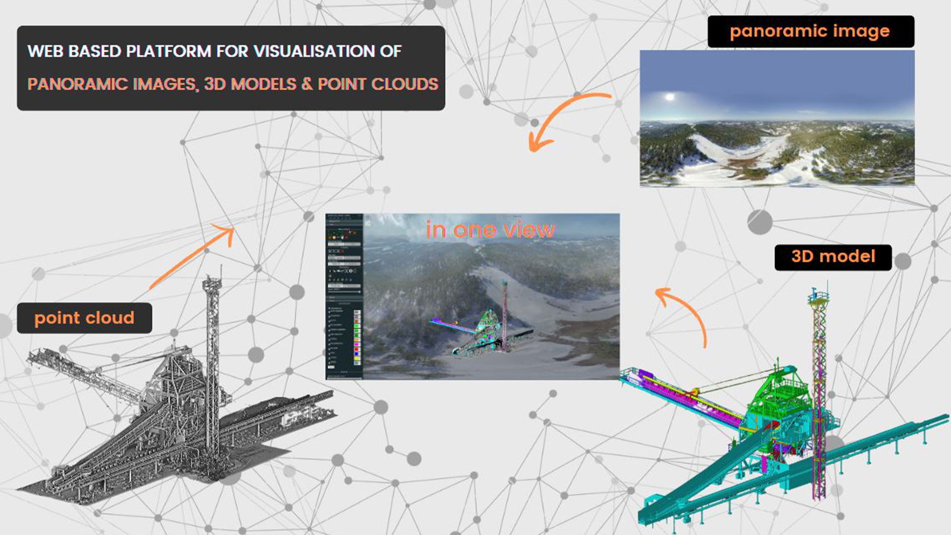
Unleash the potential of PANOTAUR and elevate your visual storytelling. Discover more about our platform by visiting PANOTAUR‘s website.

To learn more about our services, please click the “Download” button to access the Geotaur Capability Brochure.

Our services

Other services we offer

TERRESTRIAL LASER SCANNING DATA PROCESSING 03R
Terrestrial laser scanning & data processing

Laser scanning technology provides a fast and cost-effective method of getting more accurate and highly detailed 3D models of the required objects.

VERTICAL OBLIQUE PHOTOGRAMMETRY 02R 1024x576 1
Photogrammetry

Digital photogrammetry aims to establish the geometric relationship between an object and a digital image, deriving essential spatial data exclusively from the image itself.

3d modeling bim slide

3D modelling & BIM

Using various types of software Geotaur can create an intelligent BIM 3D models with specified level of detail, from LOD 100 to LOD 500.

Need some help?

We enjoy professsional challenges and we are confident that we’ll find the best solution for our clients.