GIS & Web mapiranje
Naše usluge
GIS & Web mapiranje
U GEOTAURU smo specijalizovani za GIS (Geografski informacioni sistem) usluge koje unapređuju vaše projekte i donose značajne prednosti. Naša stručnost obezbeđuje donošenje odluka zasnovanih na podacima, efikasnost i preciznost u analizi prostornih informacija. Pomažemo vam u strateškom planiranju, pojednostavljujemo složene podatke radi jasnije komunikacije, omogućavamo uvide u realnom vremenu i podstičemo nesmetanu saradnju.
Donošenje odluka zasnovano na podacima
Naše GIS usluge pružaju uvide zasnovane na podacima, koji vam pomažu u donošenju informisanih odluka. Sa GEOTAUROM možete donositi strateške izbore zasnovane na sveobuhvatnoj analizi prostornih podataka.
Efikasnost i optimizacija
Razumemo koliko je efikasnost važna za vaše projekte. Naše GIS aplikacije dizajnirane su da unaprede operacije, optimizuju tokove rada i smanje troškove, obezbeđujući da vaši projekti teku glatko i isplativo.
Preciznost i kvalitet
Preciznost je ključna u GIS-u, a GEOTAUR to isporučuje. Radimo sa najvišim nivoom tačnosti u prostornim podacima, minimiziramo greške i održavamo kvalitet vaših rezultata.
Strateško planiranje
Naša GIS rešenja podižu vaše planerske procese, bilo da je reč o transportu, urbanom razvoju ili upravljanju resursima. Omogućavamo vam strateško planiranje, smanjenje rizika i postizanje maksimalnog uspeha.
Jasna komunikacija
GIS i veb mapiranje omogućavaju jasnu i efikasnu komunikaciju složenih prostornih informacija, pretvarajući podatke u intuitivne vizuelne prikaze koji podstiču donošenje boljih odluka.
Uvidi u realnom vremenu
Budite korak ispred uz integraciju podataka u realnom vremenu. Naše GIS aplikacije vas drže u toku uz prenos podataka uživo i podatke sa senzora, pružajući vam najaktuelnije uvide za proaktivno donošenje odluka.
Pristupačnost i saradnja
Saradnja ne poznaje granice uz GEOTAUR GIS rešenja. Pristupite prostornim podacima i analizama sa bilo kog mesta, omogućavajući saradnju među članovima tima, donosiocima odluka i partnerima — bez obzira na njihovu lokaciju.
Šta nas izdvaja:
GEOTAUR je na samom čelu inovacija u GIS industriji. Naša posvećenost izvrsnosti i težnja ka najnovijim tehnologijama čine nas liderom u ovoj oblasti. Neprestano težimo da našim klijentima pružimo dodatnu vrednost, pomerajući granice onoga što GIS može da postigne.
Da biste saznali više o našim uslugama, kliknite na dugme „Preuzmi“ i pristupite Geotaur brošuri.
PreuzmiNaše usluge
Ostale usluge
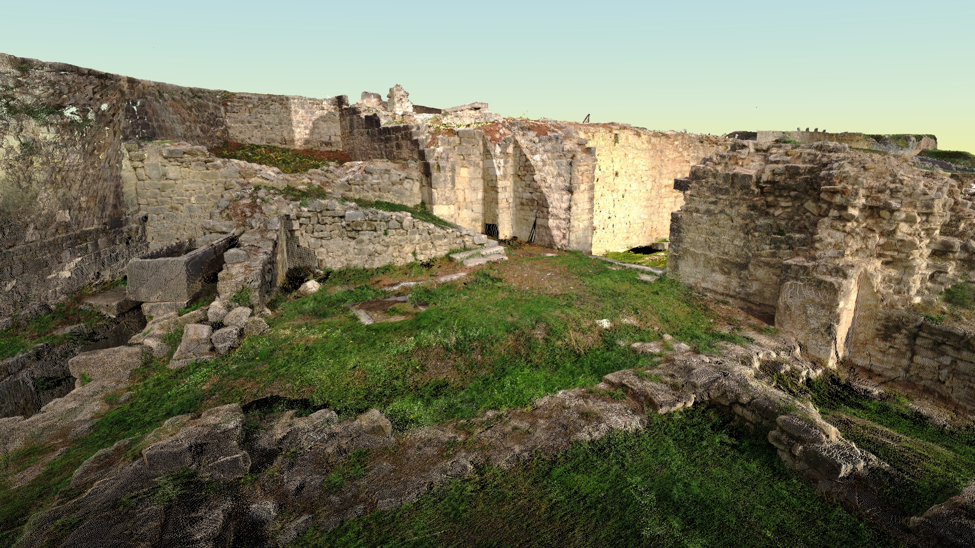
Terestričko lasersko skeniranje i obrada podataka
Tehnologija laserskog skeniranja obezbeđuje brz i isplativ način za dobijanje preciznijih i veoma detaljnih 3D modela potrebnih objekata.
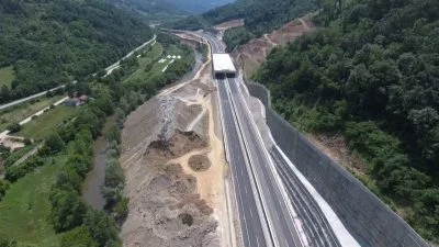
Fotogrametrija
Digitalna fotogrametrija ima za cilj da uspostavi geometrijski odnos između objekta i digitalne slike, izvlačeći ključne prostorne podatke isključivo iz same slike.
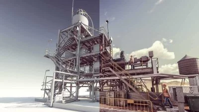
3D modelling & BIM
Koristeći različite vrste softvera, Geotaur može da kreira inteligentne BIM 3D modele sa definisanim nivoom detalja, od LOD 100 do LOD 400.