Geodetski premer
Naše usluge
Geodetski premer
GEOTAUR nudi širok spektar rešenja u oblasti konvencionalnog geodetskog premera. Naša stručnost obuhvata različite aspekte geodetskih aktivnosti, obezbeđujući precizno prikupljanje i analizu podataka za najrazličitije namene.
Topografsko snimanje
Kombinujući konvencionalnu i modernu geodetsku opremu, prikupljamo precizne podatke za izradu topografskih karata prilagođenih različitim razmerama i primenama.
Građevinsko i as-built snimanje
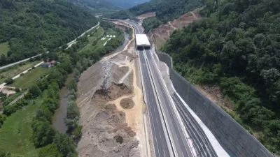
Naše usluge obuhvataju infrastrukturne projekte poput puteva, železnica, zgrada i brana. Pružamo sveobuhvatnu geodetsku podršku tokom celog životnog ciklusa projekta, uključujući snimanje postojećeg stanja, obeležavanje referentnih elemenata, horizontalnu i vertikalnu kontrolu na više nivoa, kao i as-built snimanja.
Strukturni monitoring (deformaciona analiza)
Nudimo sistematsko merenje i praćenje deformacija objekata. Parametri poput rotacije, pomeranja, nagiba, fleksije i torzije izračunavaju se sa visokom preciznošću. Naši podaci o deformacijama rigorozno se analiziraju kako bi se utvrdila statistička značajnost i proverili u odnosu na definisane granice za identifikovanje potencijalnih rizika.
Katasterski premer
Rešavamo probleme granica parcela i neslaganja u dokumentaciji zahvaljujući našoj stručnosti u oblasti katastra.
Analiziramo pravne dokumente, zvanične planove, mape koje izrađuju pravnici, inženjeri i geodete, kako bismo precizno odredili i definisali granice nepokretnosti.
Zapremenski proracuni, analize i interpretacije
Određujemo zapremine jalovišta, iskopnih površina, kamenoloma, rudničkih okna, nasipa i drugih vrsta terenskih formacija . GEOTAUR se ističe u proračunima zapremina, prikazujući podatke u različitim formatima, uključujući profile, preseke, kolor mape iskopa i nasipa (cut & fill), tabele, grafikone i dijagrame.
Da biste saznali više o našim uslugama, kliknite na dugme „Preuzmi“ i pristupite Geotaur brošuri.
PreuzmiNaše usluge
Ostale usluge
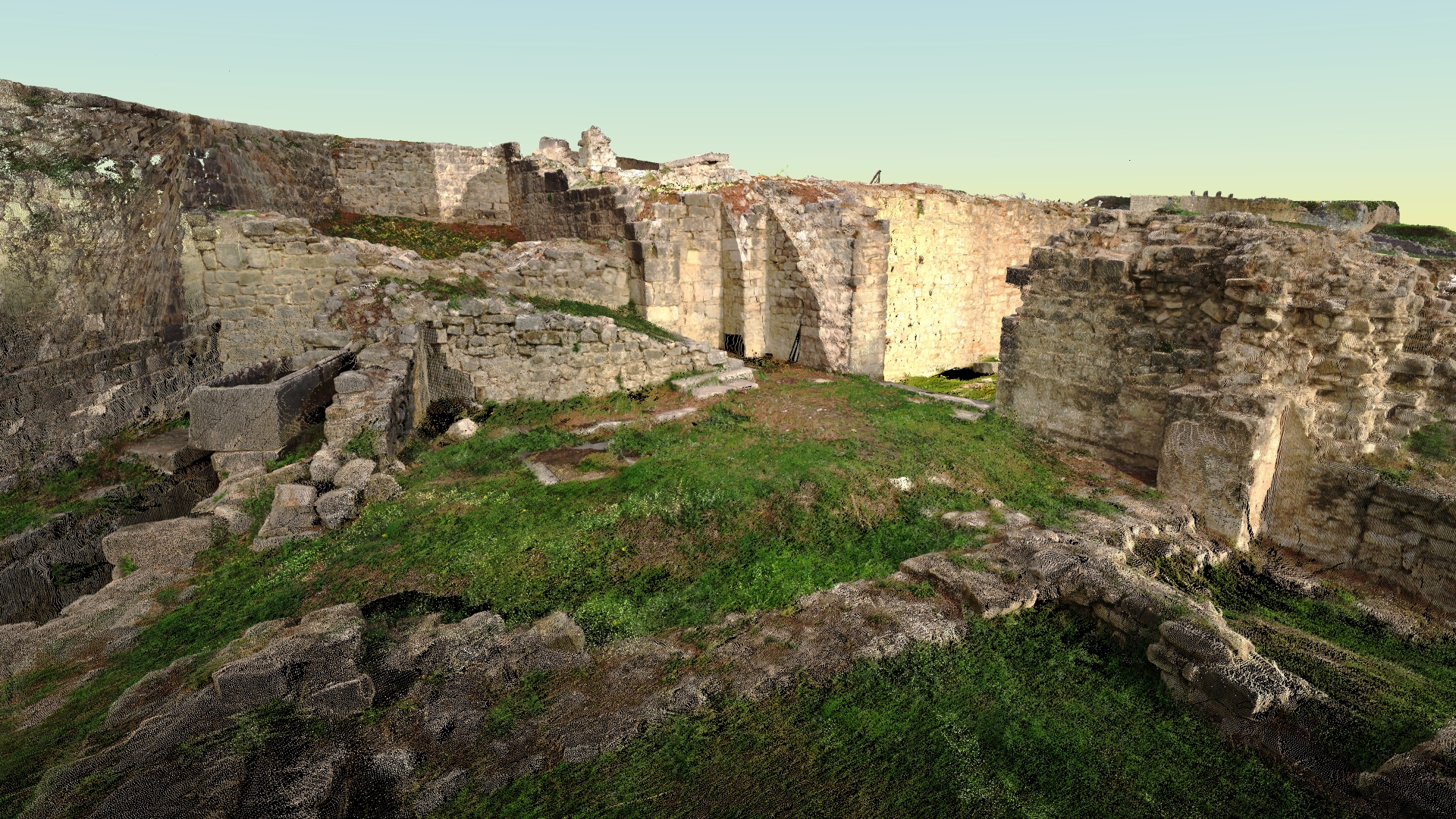
Terestričko lasersko skeniranje i obrada podataka
Tehnologija laserskog skeniranja obezbeđuje brz i isplativ način za dobijanje preciznijih i veoma detaljnih 3D modela potrebnih objekata.
Fotogrametrija
Digitalna fotogrametrija ima za cilj da uspostavi geometrijski odnos između objekta i digitalne slike, izvlačeći ključne prostorne podatke isključivo iz same slike.
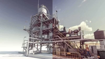
3D modelling & BIM
Koristeći različite vrste softvera, Geotaur može da kreira inteligentne BIM 3D modele sa definisanim nivoom detalja, od LOD 100 do LOD 400.